Lead your business with smart geospatial algorithms
Get access to the most complete and up-to-date digital data for your territory

Products

GIS "Atlas Intelligence"
Decision support system with web tools for
✓ delivery management
✓ territory analysis
✓ optimal locations for business selection

Smart Routing&Geofences
Spatial algorithms for
✓ optimal last mile delivery model simulation and implementation
✓ automated geofences calculation and docking

Smart Algo
Basis for Smart solutions
✓ routing - all transport types
✓ grouping - star and free float, mixed delivery
✓ geocoder - different languages
✓ address services
✓ document адщц
✓ API services

Geo Basis
Own geo-base and
Information about
✓ territories
✓ commercial facilities
✓ roads
✓ population
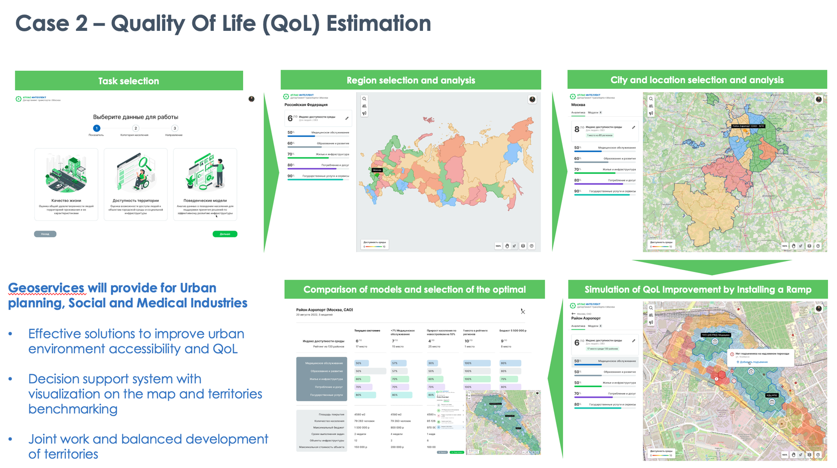
How can we help
Our data and algorithms will ensure that your business operates as efficiently as possible at a minimum cost
Build a model of optimal business in the territory
Analysis of deliveries, population and demand potential, competitive environment and solutions for optimal business operation simulation in the territory
Improve Delivery Efficiency
A set of geospatial algorithms will calculate the optimal delivery models for various business conditions
Optimize the cost of geoservices
Compared to major market players, our solutions are available at the best price, more flexible and easily adaptable to individual customer needs
Get information about the territory
Our algorithms are based on digital data with the widest territorial coverage and quality
Will be happy to make a product demonstration for you


Illustrations by Storyset
